Lake Kinneret, Buhira Tibria or Sea of Galilee has a special significance among Muslims because of the prophecy associated with the drying of the lake. It has been reported in a famous tradition (Hadeeth of Tamim ad Dari) that the drying up of the lake will usher in the era of the anti-Christ (Dajjal). Further details on the prophecy can be found in this article.
The water from the lake serves as a fresh water reservoir for Israel. In addition to domestic use, over the last decade, the increase in farming in the region has also seen more of lake’s water being used for irrigation purposes.
Based on Kinneret’s water levels, environmentalists have come up with three warning lines to use the lake’s water in a sustainable manner.
Upper Red Line (209 m below Sea-level): Indicates the maximum capacity of the lake. If water levels are higher than the upper red line, than the access water is drawn off through dams.
Lower Red Line (211 m below Sea-level): The lower red line indicates the level when water from the lake should not be pumped further.
Black line (215 m below the Sea-level) : The black line indicates the level at which fresh water occupying the top layer will mix with the dense saline water at the bottom. If water level falls below this line, it will be detrimental for the ecology, particularly for the fresh water species in lake.
Furthermore, if water level dips below the black line, the lake will go into an irreversible cycle where the natural replenishment would be less than the evaporation from the lake.
The lake mainly feeds of River Jordan which in turn is resourced by the precipitation and snow on Golan Heights. There are also other streams like Nahal Meshushim, Nahal Amud, Nahal El-Al and Nahal Yehudiya which feed into the lake.

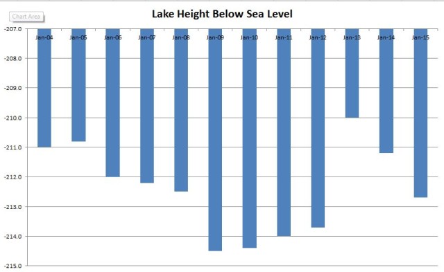
The water levels go up from December to July (in line with rain and snow fall/melt) and thereafter decline. The pattern remains the same but the level of rise and fall can vary. Over the past decade, the overall trend has been a steeper decline than the seasonal rise. This has led to the lake levels consistently record new lows during peak times. The water levels now remain close to the lower red line and are inching towards the black line.
It should be noted that often when the water is scarce, the Redlines are lowered by the authorities. This allows over-pumping which further depletes the lake. There also exists a school of thought which does not deem the black line as a halting point. Dr. Josef Guttman for instance opined that while by-passing the black line would be extremely undesirable but the damage would be reversible over time.
It should be noted that many Israel based environmental groups have campaigned in the past for keeping the pumping in check. As desalination plants have become active, the situation in recent years has improved.
The latest data however suggests that the gains made by desalination plants are reversing.
The most recent information on water levels can be accessed from the following twitter handle:
https://twitter.com/kinbot
As of 14th December 2015, the height of the lake remained at -213.035m i.e. approximately 4 cm below the lower red line.
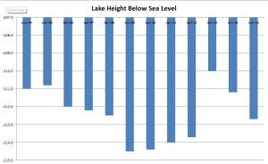
Table for lake depth over the years (2004- 2015)
| Year | Height Below Sea Level |
| Jan-04 | -211.0 |
| Jan-05 | -210.8 |
| Jan-06 | -212.0 |
| Jan-07 | -212.2 |
| Jan-08 | -212.5 |
| Jan-09 | -214.5 |
| Jan-10 | -214.4 |
| Jan-11 | -214.0 |
| Jan-12 | -213.7 |
| Jan-13 | -210.0 |
| Jan-14 | -211.2 |
| Jan-15 | -212.7 |


